
Europe’s wildfires, in maps, charts and photos - NBC News
What the report says
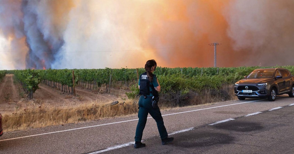
NBC News reported that a wave of wildfires in France and Spain has scorched more than 600 square miles over a two-week period, forcing tens of thousands of residents and tourists to leave affected areas. The outlet’s July 29, 2026, visual report, updated July 30, used maps, satellite imagery and before-and-after views to show the extent of burned land in both countries.
In Spain, NBC cited more than 450 square miles burned in the previous two weeks. One image highlighted smoke over Fermoselle, a municipality near the Portuguese border, on Wednesday, underscoring the fires’ effect on communities in western Spain. The report was by Ashley Mowreader and Jiachuan Wu.
The fires matter because they have affected both local populations and visitors during Europe’s summer travel season, while also damaging large areas of land across two countries. Visual evidence such as satellite maps and comparison images can help show the scale and location of fire damage when ground conditions are difficult to assess.
Beyond NBC’s reported details, wildfires in southern and western Europe are a recurring seasonal hazard, often worsened by heat, dry vegetation and wind. The supplied article text does not specify causes, casualty figures, containment levels or government response measures, so those details should not be inferred from this report alone.
Loading debate for this article…
Other publishers covering this story
No additional verified coverage is currently clustered with this report.
Related reporting
 B’Tselem: Israeli settler violence aims to eliminate Palestinian existenceAl Jazeera
 Russia resupplies military bases in Syria for first time under new dealAl Jazeera
 Geneva talks put Rwanda-DRC peace deal to the testAl Jazeera
 Sweden election is too close to call as far right loses groundAl Jazeera
 Iran war live: CENTCOM refutes Iran claim supertanker hit Hormuz minesAl Jazeera
 Landowners in Texas ask court to stop Trump border wallAl Jazeera