
Europe's scorched landscapes seen from space after summer heatwaves
What the report says
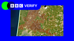
BBC Verify reports that the effects of a prolonged run of summer heatwaves across western Europe are now visible in satellite imagery, with signs of drought, wildfire damage, shrinking glaciers and depleted rivers. The coverage draws on images from Copernicus Sentinel-2 and compares conditions across several countries, including France, Switzerland, Germany, Hungary, Romania, Serbia, Bulgaria and the UK.
According to the BBC, rivers have been among the hardest hit. The Danube has fallen to very low levels in several countries, exposing unusual objects on the riverbed and disrupting operations along the waterway. On the Rhine, low water has affected shipping and forced some cruise cancellations. The report also says nuclear power stations in Hungary and Romania have had to reduce output or stop temporarily because river water was too warm or too low for cooling.
In the Alps, satellite images suggest glaciers have retreated rapidly after a mild winter and an early heatwave, while wildfire scars have expanded across parts of France. The BBC cites European climate monitoring data saying western Europe had its hottest June-to-July period on record, and notes that climate change is making hot, dry spells more likely and more intense. The report says this matters for farming, water supplies, transport, energy and ecosystems, as large areas of land show signs of stress.
Loading debate for this article…
Other publishers covering this story
No additional verified coverage is currently clustered with this report.
Related reporting
 Iran war live: Trump claims war will end ‘very soon’, gives no detailsAl Jazeera
 Trump says he plans to campaign for 32 days before midterm electionsAl Jazeera
 ‘Nothing is justifying this’: Qatari PM slams atrocities in GazaAl Jazeera
 Trump, top tech firms sign accord to ‘self-police’ AI developmentAl Jazeera
 Ukraine's prized steel industry left in ruins by Russian missile campaignBBC World News
 Jack Smith defends investigations into Trump during tense US Senate hearingAl Jazeera